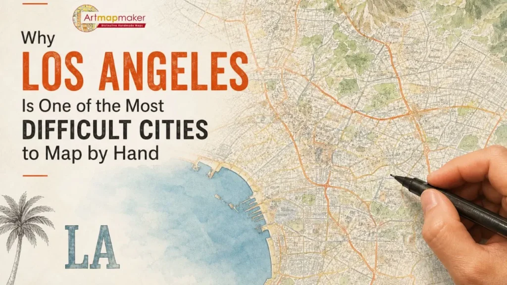
Los Angeles is not just a city. It is a sprawling network of neighborhoods, freeways, coastlines, and micro-cultures layered across hundreds of square miles.
From a cartographic perspective, it is one of the most complex urban landscapes in the United States to draw by hand.
Unlike compact cities with centralized layouts, Los Angeles resists simplification. Every attempt to map it requires balance between accuracy, scale, and visual clarity. That is what makes it both fascinating and technically challenging in traditional hand-drawn cartography.
At Art Map Maker, cities like Los Angeles represent the highest level of difficulty in pen-and-ink cartography, where every detail must be carefully composed rather than automatically generated.
A City Without a Single Center
Most traditional cities grow around a central point: a downtown core, a river junction, or a historical hub.
Los Angeles does not follow this pattern.
Instead, it is a collection of interconnected regions that function almost like independent cities:
- Downtown Los Angeles
- Hollywood
- Santa Monica
- Beverly Hills
- Pasadena
- Long Beach
- San Fernando Valley
Each of these areas has its own identity, structure, and density.
For a cartographer, this creates an immediate challenge: there is no natural focal point to anchor the composition.
Scale vs. Detail: The Core Mapping Challenge
When drawing a city by hand, one of the biggest decisions is how much detail to include.
Los Angeles makes this especially difficult because it is both extremely large and extremely detailed.
If you zoom out too far, you lose the character of neighborhoods.
If you zoom in too closely, the map becomes visually overwhelming.
This tension forces the cartographer to make deliberate choices:
- Which highways to emphasize
- Which neighborhoods to simplify
- How to balance coastline detail with inland density
- Where to reduce visual noise without losing identity
These are not mechanical decisions. They are compositional decisions.
The Freeway System as a Cartographic Puzzle
One of the defining features of Los Angeles is its freeway network.
Highways like the 405, 101, 10, and 5 are not just transportation routes. They are structural elements that define how the city is experienced.
From a mapping perspective, they create a dense web of intersecting lines that can easily overwhelm a composition if not carefully managed.
In hand-drawn cartography, these elements must be:
- Simplified without losing accuracy
- Balanced visually with surrounding geography
- Integrated into the map’s overall hierarchy
A poorly handled freeway system can dominate the entire artwork. A well-handled one becomes part of the city’s rhythm.
Coastal Geometry and Natural Boundaries
Los Angeles also presents a unique coastal challenge.
Unlike cities with simple river boundaries or uniform shorelines, LA’s coastline is irregular and visually complex.
From Malibu down to Long Beach, the coastline shifts constantly in shape and texture. It includes:
- Beaches
- Cliffs
- Harbors
- Industrial ports
- Residential coastal zones
Each of these areas behaves differently on a map.
Capturing this variation requires careful linework control and subtle transitions in shading so the coastline feels natural but not chaotic.
Neighborhood Density and Visual Hierarchy
Another challenge in mapping Los Angeles is density variation.
Some areas are highly dense with street grids and labels. Others are more open and spread out.
A cartographer must decide how to maintain hierarchy so the viewer can still understand the structure of the city at a glance.
This involves:
- Adjusting typography scale by region
- Prioritizing major roads over minor streets
- Controlling spacing between labels
- Maintaining visual breathing room in dense zones
Without these decisions, the map becomes unreadable.
Why Hand-Drawn Cartography Handles LA Differently
Digital mapping systems solve complexity through automation. They can display every road, every label, and every layer at once.
But hand-drawn cartography does something different. It interprets complexity instead of just displaying it.
This is where artistry becomes essential.
In a city like Los Angeles, interpretation is not optional. It is required.
A hand-drawn map must decide what matters most about the city’s identity and express that visually without overwhelming the viewer.
That balance between clarity and detail is what separates mechanical mapping from fine art cartography.
The Emotional Layer of Mapping Los Angeles
Beyond technical difficulty, Los Angeles also carries emotional complexity.
For many people, it represents:
- Opportunity
- Entertainment culture
- Career beginnings
- Reinvention
- Migration and identity shifts
This emotional weight adds another layer to the mapping process.
A hand-drawn map of Los Angeles is not just a geographic representation. It is often a personal symbol tied to life transitions, achievements, or memories.
That is why custom cartographic art of LA often becomes more than decor. It becomes a visual anchor for personal history.
Why It Still Matters in 2026
In 2026, digital maps can render Los Angeles instantly in full detail, complete with real-time traffic and satellite layers.
But that is not the same as understanding the city visually.
Hand-drawn cartography slows Los Angeles down.
It removes noise. It reduces overload. It translates complexity into something structured, intentional, and aesthetically meaningful.
Instead of showing everything, it shows what matters most.
And that is what makes it valuable as art.
Because Los Angeles is not difficult to map due to lack of information.
It is difficult to map because it contains too much of it.
And choosing what to keep is where the real craft begins.